Microsoft SQL Server Version Comparison

Microsoft SQL Server may be used as the database engine for the RavTrack PC AVL system.

A free version is available from Microsoft, called “Express”.  For small AVL systems where the number of tracked vehicles is small (< 25) and the update rate is fairly slow (< 30 seconds), then the EXPRESS version is probably a good choice. But, for systems requiring higher performance, Microsoft provides a number of high-performance options.

The following table describes the primary differences between the various SQL implementations.

Scalability and Performance

Feature Express Workgroup Standard Enterprise Comments
Number of CPUs 1 2 4 Max OS supported Includes support for multicore processors.
RAM Used
1 gig(GB) 3 GB OS maximum OS maximum Memory limited by operating system.
64-bit Support Windows on Windows (WOW) WOW Available Available
Database Size 4 GB No Limit No Limit No Limit
Partitioning Available Support for large-scale databases
Parallel Index Operations Available Parallel processing of indexing operations
Indexed Views Available Indexed view creation is supported in all editions.

GPS Position Accuracy

The accuracy of a position determined by using a GPS receiver is limited by the accuracy of the GPS signal itself.  The US government controls the precision of the GPS signals sent from the GPS satellite constellation.   It varies from day to day, and the following graph shows historically, how precise the GPS position information is.

gpsaccuracyRaveon’s GPS transponders utilize the WAAS signal, so accuracies of 2-3 meters are possible.  Laboratory tests with the M7 series of GPS transponders confirm that this is possible, but typically, the accuracy is in the 3-5 meter range.
If the GPS transponder is located indoors, or if there are very tall buildings near the transponder, the accuracy will be degraded due to multipath of the GPS signal.

AVL News: Newer, faster Google Earth 5.1 released

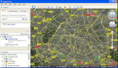
The team over at Google has released a speedier version of their popular Google Earth application. From our tests here, we did notice some welcome speed increases in rendering the map tiles when you zoom in and out and change views. Also, start up time did seem reduced compared to version 5.0. Additionally, Google has sped up the rendering of 3D models within Google Earth. Of course, since RavTrack’s AVL solutions support open formats such as KML, this means that Google Earth is now faster while rendering KML for display with a map overlay. For more information on using RavTrack AVL with Google Earth check out our recent announcement.

From the Google Lat Long blog:

We’ve made a lot of adjustments under the hood, like improving memory utilization so we can show more buildings, layers, and user content. We improved our shaders (that’s graphics-speak for small programs that run inside your graphics processor) to make the atmosphere draw faster. We also worked to reduce stuttering (known as frame drops) to provide an even smoother experience as you fly around the globe. When we draw imagery, we now use compression technology to use less memory and graphics resources. We know that waiting for a program to start-up can be really frustrating, so we improved our start-up time by 25%. In our Google Earth API (which allows developers to include Google Earth right in their websites), we have made API calls significantly faster, which means that our developers can now do even more.

Tracking Construction Equipment

Often, during large-scale construction projects heavy equipment such as bulldozers or front-end loaders are left on site overnight or after hours. It simply does not make sense to move them back and forth. Unfortunately, this can make your construction equipment a target for theft costing tens of thousands if not hundreds of thousands of dollars.

Luckily, any vehicle or piece of construction equipment can be tracked and monitored in real-time using the RavTrack AVL tracking solutions from Raveon Technologies. With RavTrack, you know with certainty where all your work site assets and equipment are located; all in real-time and without the expensive recurring fees that accompany most other AVL systems. Using RavTrack AVL, you can monitor your job site and keep an eye on how your equipment is being used, even in remote areas where other products fail.

GPS-Guided Robot Jumps Over 25 Foot Obstacles

On the lighter side of GPS tracking, we came across this incredible video of a robot that uses GPS to find its away around. The Precision Urban Hopper is being developed by Sandia Labs and Boston Dynamics. Using GPS to navigate is nothing new in robotics, but the way the Hopper handles obstacles is pretty unusual.

Sandia said hopping has “shown to be five times more fuel-efficient than hovering,” when it comes to getting around obstacles less than 30 feet tall. (Via CNET)

Don’t miss the video.

Calculating Fuel Tax with GPS?

truck fuel tax with gpsI just read an interesting article about how trucking fleets are using GPS to calculate their fuel taxes. Since fuel taxes are generally handled by the states and since truckers typically operate across state lines they often need to calculate their usage in various locales. GPS position reporting is a good way to do this as not only would it report your GPS location but it would also report the time for each position report. Ideally, you could automate this process with reporting transmitted as you go.

It is likely that state and local governments will increase their use of GPS to support pay-as-you-go taxation paradigms.

While it seems like a difficult task to calculate your fuel taxes, GPS tracking of your fleet can only make it easier. Consider this description:

This can be an onerous administrative task.  If you have a fleet of over 50 trucks, there is a good chance you have one person, perhaps making $40,000 annually, focused solely on this paper-intensive task.  But the process can be automated if a company uses GPS/telematics devices in its trucks, along with fuel cards and IFTA tax reporting software (or a tax service provider that uses this kind of software).  Then the mileage driven in each state and fuel expenditures for a particular vehicle can be automatically loaded into the software and the proper IFTA reports can be printed.  The process becomes much less paper intensive.  While a fleet operator would probably never buy a telematics solution solely to eliminate a clerical position, it can contribute to the ROI offered by telematics solutions.

Tracking Stolen Trucks with GPS

tracking tow trucks with gps
GPS tracking solutions like RavTrack are useful for more than the usual vehicle tracking. You can also use RavTrack to track stolen assets and recover stolen property with GPS. In Fort Launderdale, a tow truck company owner tracked down two of his trucks that had been stolen:

What the culprits didn’t know was that the Ford F-450s were equipped with high-end GPS tracking systems that would chart their every move over the next 36 hours.

Fort Lauderdale police arrested two men for the theft of the wreckers, which had wireless GPS tracking hardware installed on them. Police used GPS position reporting to capture the suspects.

Jason Parrett, owner of the Fort Lauderdale repossession truck company First Response Towing and Recovery, said the Global Positioning System units were crucial to finding the missing wreckers.

“Without it we wouldn’t have found the trucks,” said Parrett, who has equipped all three trucks in his fleet with GPS technology.

Parrett said an employee called him early Saturday to tell him the two trucks were missing.

Once Parrett figured out which two trucks were gone, he asked his wife to pull up their locations on her BlackBerry, which is linked to their GPS units.

When the police arrived, the owner provided the GPS system’s activity report, which showed where the trucks had been, places where they had been parked for extended periods and how fast they had been driven. The police later arrested the two men at one of the locations listed on the GPS report.

“The detailed activity reports in these are disgustingly accurate,” Parrett said of the system.

ATLAS PL Personal Locator Battery Performance

The ATLAS PL Personal GPS Locator operates off of two internal Lithium-Ion battery packs. Combined, the two batteries deliver 6.8 – 8.6V to the internal radio circuitry.  As the ATLAS PL is used, the batteries discharge, the battery voltage drops, and the RF power will slightly decrease.

Below is a table showing typical RF power output verses battery life.

Time (Hrs) Cell Voltage Pack Voltage % Battery Remaining   RF Power Output TX Current
0 4.30 8.60 100%   5.0  
1 4.10 8.20 92%   4.7 2.9
2 4.00 8.00 83%   4.6  
3 3.90 7.80 75%   4.4  
4 3.85 7.70 67%   4.4  
5 3.82 7.64 58%   4.3  
6 3.80 7.60 50%   4.3  
7 3.75 7.50 42%   4.2  
8 3.70 7.40 33%   4.2  
9 3.68 7.36 25%   4.1  
10 3.65 7.30 17%   4.1  
11 3.50 7.00 8%   3.9 2.8
12 3.40 6.80 0%   3.7  

The above data is represented graphically in the following chart:

Atlas PL battery voltage chart


The time duration that the ATLAS PL will operate before its batteries must be recharged is dependent upon the GPS mode and the position transmission/update rate.

Below is a chart showing approximate battery life.  The Green line is if the PL is operating in GPS mode 2, 4, or 9 with the UHF radio receive enabled.   The Blue line is GPS mode 9 with the receive disabled (Transmits position only).

pl_batterylife_1

pl_batterylife_2

Search and Rescue GPS with Atlas PL

gps trackingLast week, Raveontech announced their Atlas PL, personal GPS locator. The Atlas PL is ideal for tracking emergency response teams, search and rescue personnel, wildfire teams and firefighters, as well as security teams. It has many useful features suited for tracking personnel with GPS including some new and advanced safety features including: automatic “Man-Down” alert, manual alert, critical alert, and proximity alerts that are transmitted along with position and status. Read more information on the Atlas PL GPS personnel tracking system and these new safety features.

Bus Fleets Displaying GPS Position in Real-Time

EJ I TRAFIK
Creative Commons License photo credit: bengt-re

In Washington, D.C., the traffic authorities responsible for the local commuter bus system there have developed a new service for sharing the position of each bus in real-time. The new service is quaintly called “Where’s my Bus?” and displays the GPS position of your bus. The service is viewable via the web or from any Internet-enabled smartphone such as the iPhone or Blackberry. Obviously, this improves the service in a significant way in that riders no longer have to worry where the bus is and can use the bus system more efficiently. We expect the trend of sharing GPS position data for individual vehicles to continue, especially in consumer-focused services such as commuter transport or car services and limousines. It is easier to be patient when you know exactly where your bus or taxi is located at any time while you wait.

The District Department of Transportation’s Gabe Klein explains the value of the “Where’s my Bus?” service:

DDOT Director Gabe Klein says it’s a new world. “I think smart phones are becoming the norm for people in urban environments.”

Customers now want information, on demand, any time and anywhere. “In the winter, it’s cold. Wouldn’t you rather be waiting in your office for 9 or 10 minutes?”

Using GPS technology, DDOT’s application allows riders to track each bus down to a tenth of a mile. From Klein’s office at 14th and U Streets, he tests the programs accuracy. “I’m going to hit refresh and sure enough, it’s at 14th and T.”